|
| *****SWAAG_ID***** | 979 |
| Date Entered | 25/02/2017 |
| Updated on | 27/02/2017 |
| Recorded by | Tim Laurie |
| Category | Photographic Record |
| Record Type | Northern Britain |
| SWAAG Site Name | |
| Site Type | |
| Site Name | |
| Site Description | |
| Site Access | Public Access Land |
| Record Date | 24/02/2016 |
| Location | Cotherstone Moor. Hunder Beck upstream from Mawmon Sike and its tributaryGills, Crawlaw Gill and Slates Fell Gill |
| Civil Parish | Cotherstone |
| Brit. National Grid | NY 929 169 |
| Altitude | 335m |
| Geology | Upper Carboniferous, Namurian strata including very thick, black mudstones and silty shales between the Upper Stonesdale Limestone and the Lower Fell Top Limestone.
This strata is well exposed within the steep sided stream cut ravines, at waterfalls and at the two ,distant isolated nunatak-like hills which have escaped glaciation.
This area is littered with glacial erratic boulders, mainly of local millstone grit but with numbers of shap granite and other igneous rocks of distant origine. These erratic boulders will be the subject of further database records. |
| Record Name | Hunder Beck and its tributary streams. Part Three upstream from the confluence with Mawmon Sike. A walk on the wild side! |
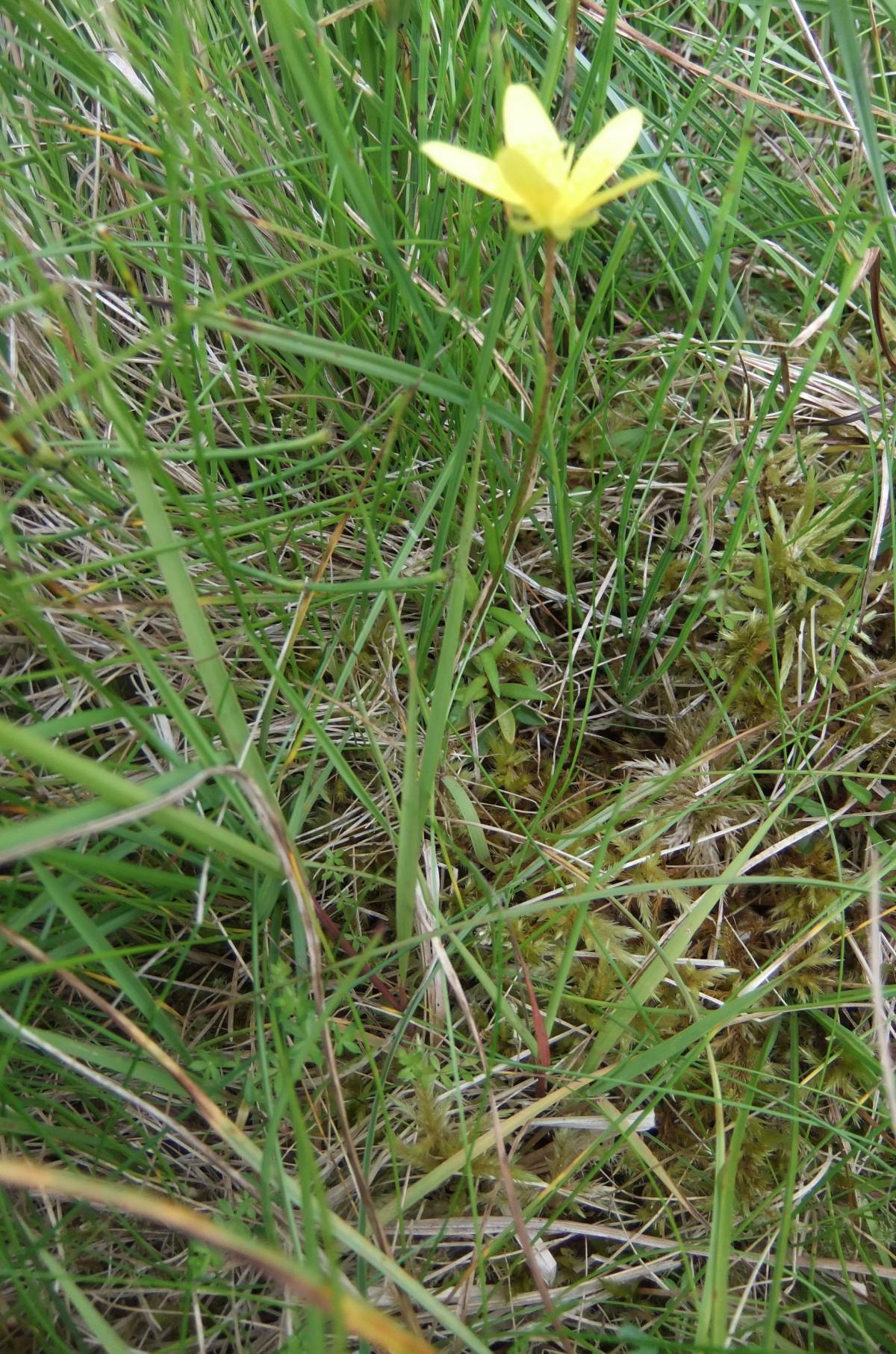
| Record Description | This photographic record is intended to provide a flavour of the fine wild Pennine Landscape centred on the two isolated hills of Goldsborough and Shacklesborough. This moorland is an extensive sheep run drained by Hunder Beck and its tributary streams which have cut deep ravines through the soft black shale strata. These moors conceal hidden waterfalls and are home to one of the rarest and most delicate of British Arctic/Alpine flowers- the Yellow Mountain Saxifrage (Saxifraga hirculus). Saxifraga hirculus was recentltly discovered within the equally beautiful wilderness of Stainmore.
This is moorland to explore alone or with a friend, not with a rambling group.
This area has been the subject of previous swaag database records, as follows:
Swaag Record Nos 645,646,647,663,665,842,973
The distribution of Shap Granite erratic boulders photographed during this walk will be the subject of separate Swaag Database Records. |
| Dimensions | See photographs |
| Geographical area | |
| Species | |
| Scientific Name | |
| Common / Notable Species | |
| Tree and / or Stem Girth | |
| Tree: Position / Form / Status | |
| Tree Site ID | 0 |
| Associated Site SWAAG ID | 0 |
| Additional Notes | Please note that the photographs are listed more or less in the order taken during a walk above and through Hunder Beck Gill, Crawley Gill and Slateshill Gill returning over Hunder Rig. Those of Shacklesborough are included last as they were taken by telephoto lens from Hunder Rig at this walk.
I was unable to reach Shacklesborough during this recent walk on a fine February Day and aim to get to it on the next fine day. Years ago I walked across the summit of Shacklesborough and recognised a low round cairn on the summit, presumably a bronze age burial mound.
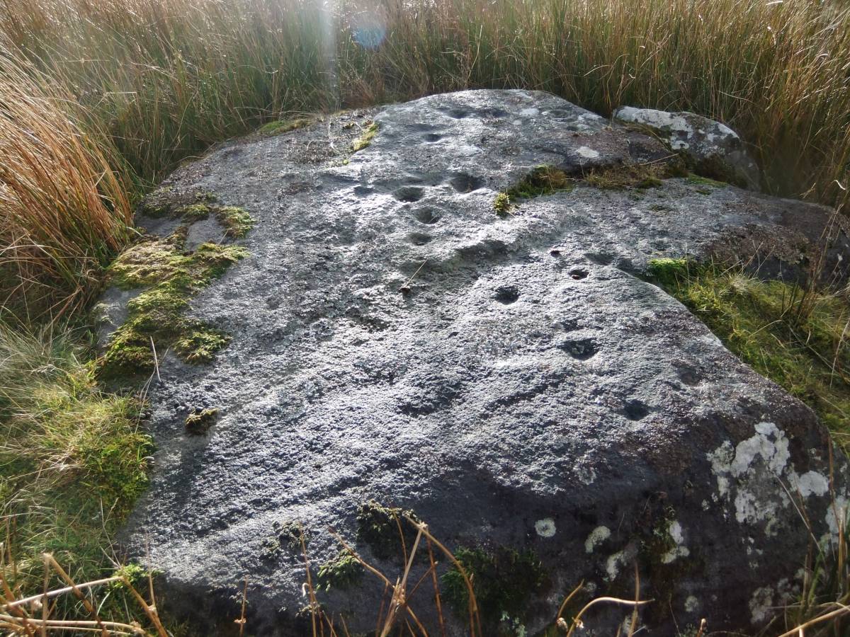
The presence of a ring cairn and of cup and ring marked rocks on the ridge east of Goldsborough and close of West Loups Farm on the Army Battle Hill Firing Range together indicate that these two isolated distinctive hillocks were clearly recognised as special localities during later prehistory. |
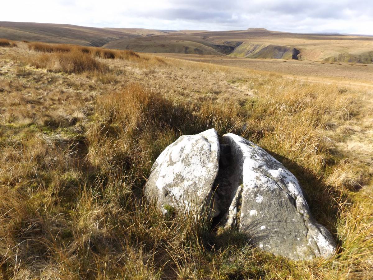
| Image 1 ID | 7195 Click image to enlarge |
| Image 1 Description | West How Hill. Erratic gritstone boulder split by frost or by lightning perhaps. Distant view of Shacklesborough. |  |
| Image 2 ID | 7196 Click image to enlarge |
| Image 2 Description | Distant view of the waterfall on Mawson Sike and of Shacklesbrough. | 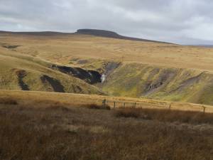 |
| Image 3 ID | 7197 Click image to enlarge |
| Image 3 Description | View northward across Hunder Beck. | 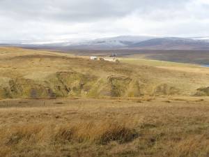 |
| Image 4 ID | 7198 Click image to enlarge |
| Image 4 Description | View through Crawlaw Gill to Shacklesborough |  |
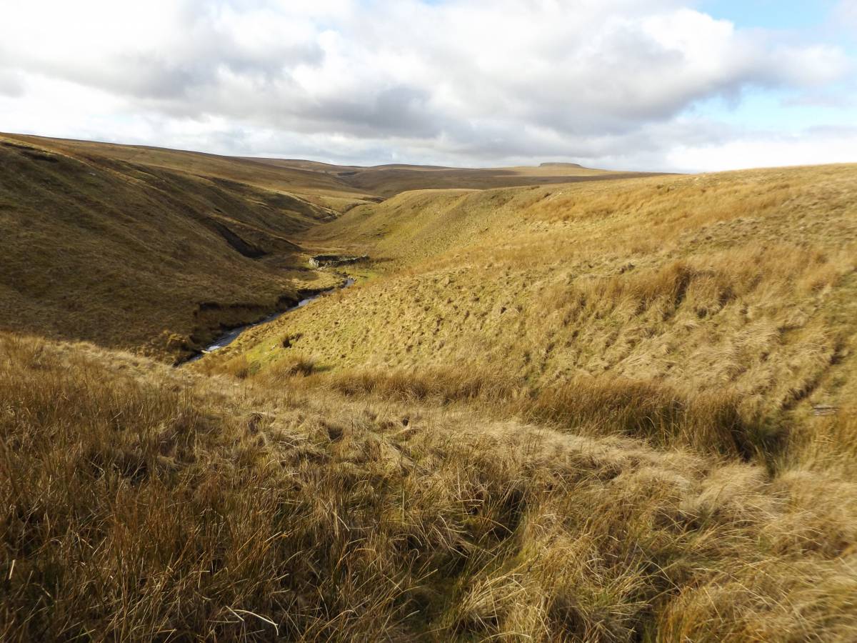
| Image 5 ID | 7199 Click image to enlarge |
| Image 5 Description | Crawlaw Gill. Interlocking spurs. | 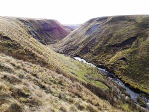 |
| Image 6 ID | 7200 Click image to enlarge |
| Image 6 Description | Crawlaw Gill. Interlocking spurs. | 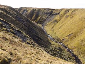 |
| Image 7 ID | 7201 Click image to enlarge |
| Image 7 Description | Crawlaw Gill. Interlocking spurs. | 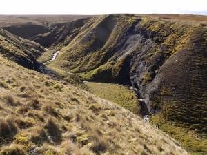 |
| Image 8 ID | 7202 Click image to enlarge |
| Image 8 Description | The Crawlaw Stone. See also Swaag Record 663. | 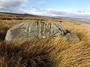 |
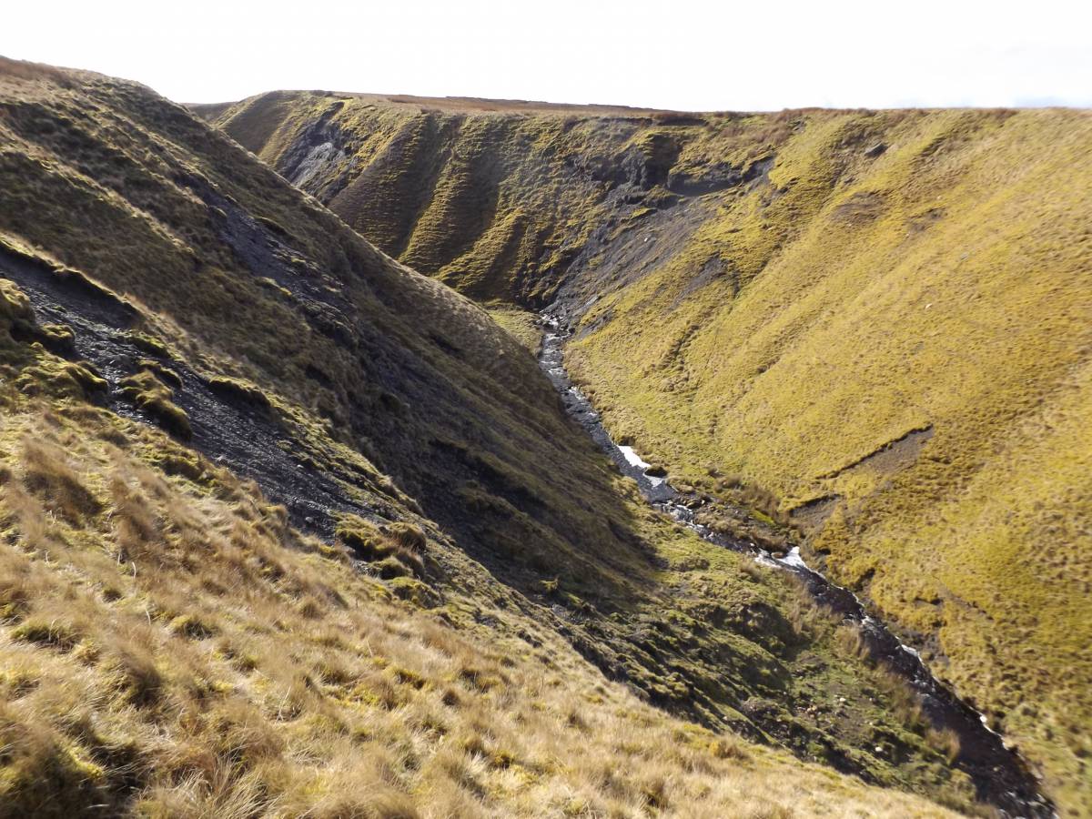
| Image 9 ID | 7203 Click image to enlarge |
| Image 9 Description | Slateshill Gill and falls. | 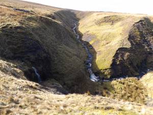 |
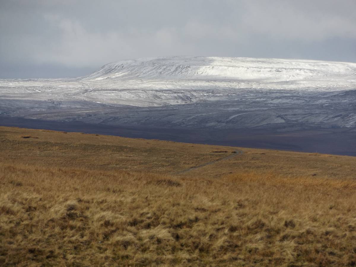
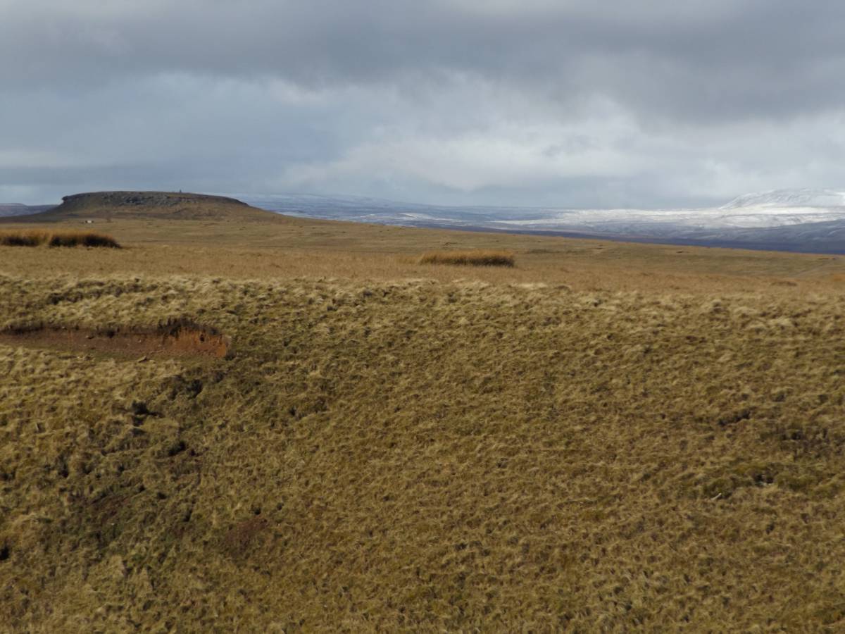
| Image 10 ID | 7204 Click image to enlarge |
| Image 10 Description | Distant view of Mickle Fell under snow, from Hunder Rig. | 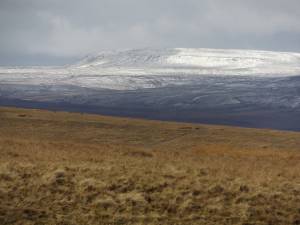 |
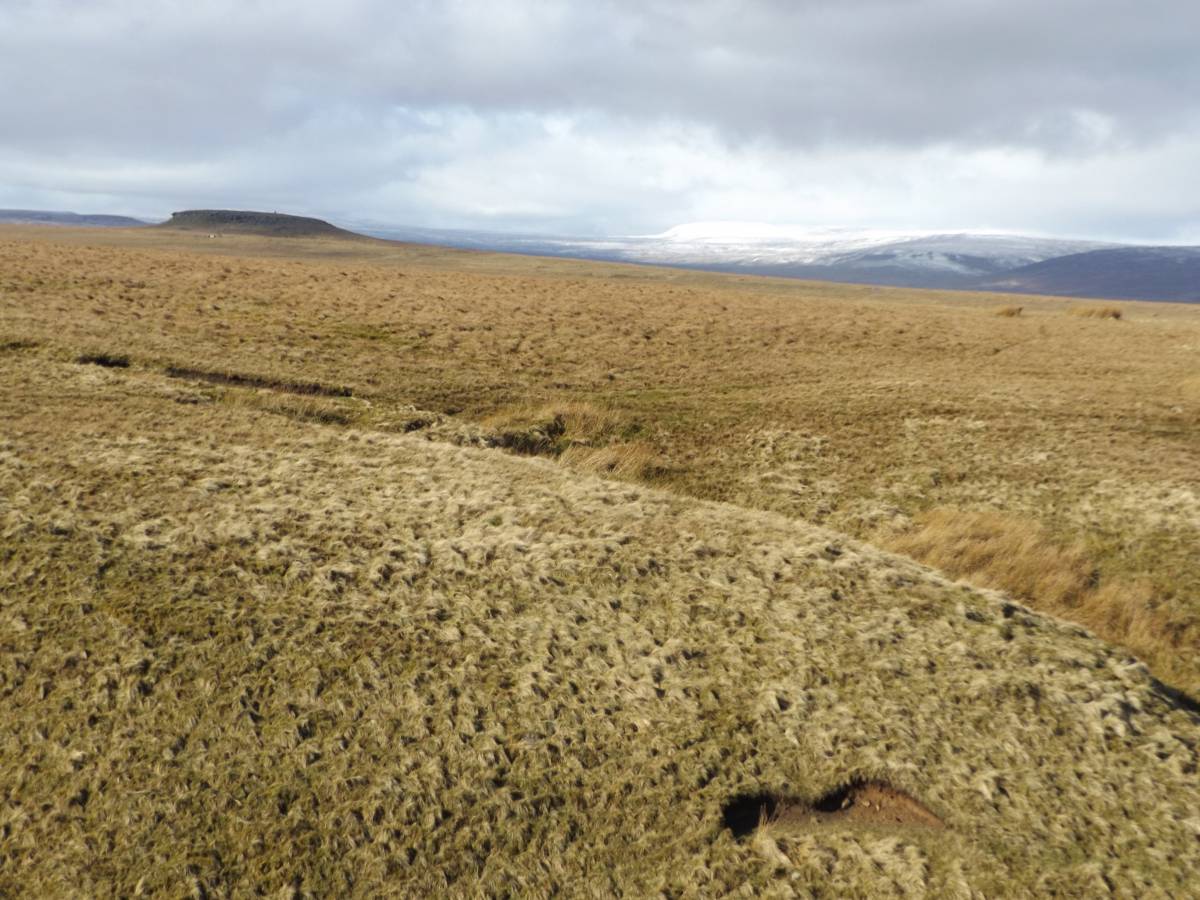
| Image 11 ID | 7205 |
| Image 11 Description | Shacklesborough from Hunder Rig |  |
| Image 12 ID | 7206 |
| Image 12 Description | Shacklesborough from Hunder Rig | 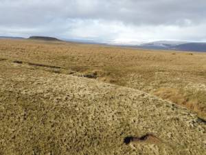 |
| Image 13 ID | 7207 |
| Image 13 Description | Stone keeper's hut at head of Crawlaw Gill | 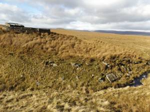 |
| Image 14 ID | 7208 |
| Image 14 Description | Stone keeper's hut at head of Crawlaw Gill | 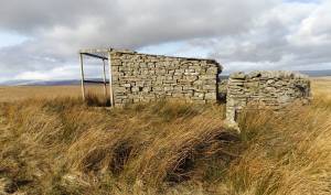 |
| Image 15 ID | 7212 |
| Image 15 Description | Saxifraga hirculus photographed on Stainmore |  |
| Image 16 ID | 7209 |
| Image 16 Description | View westward from Goldsborough to Shacklesborough | 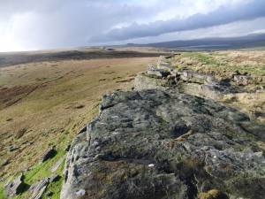 |
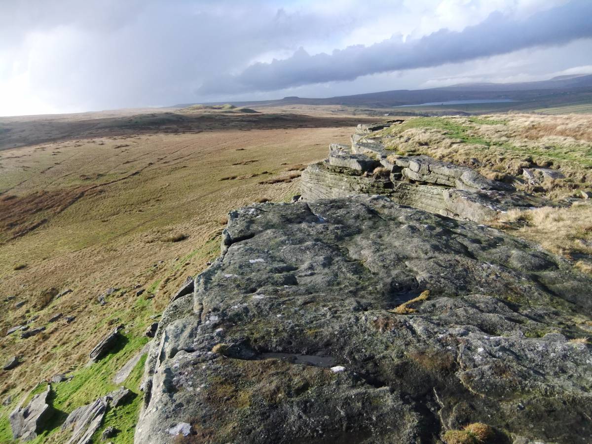
| Image 17 ID | 7210 |
| Image 17 Description | Goldsborough, sandstone cliffs | 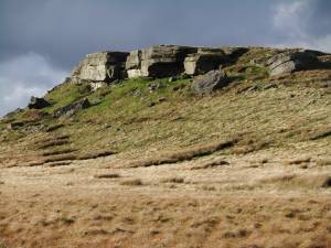 |
| Image 18 ID | 7211 |
| Image 18 Description | Cup and ring marked rock east of Goldsborough |  |
| Image 19 ID | 7219 |
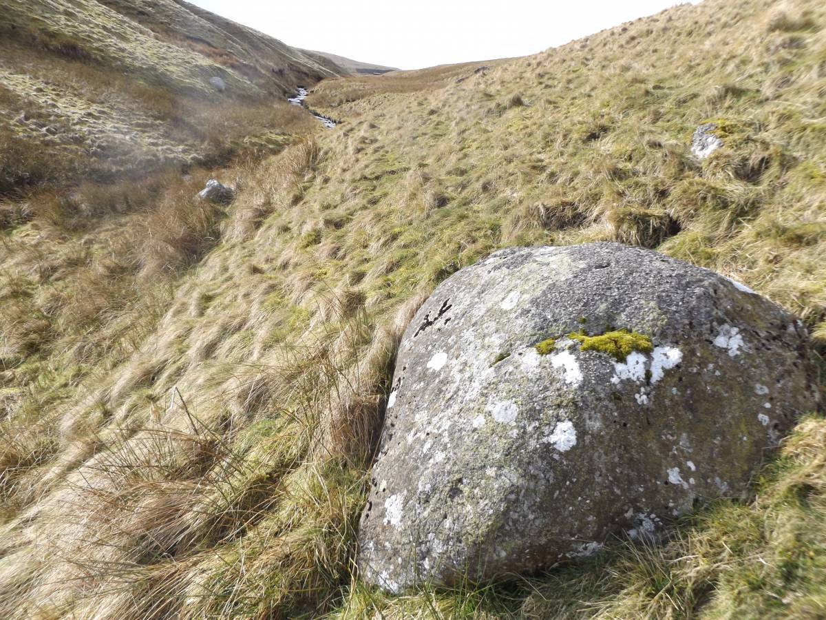
| Image 19 Description | Hunder Beck, Shap erratic boulder. One of several similar large boulders recognised on both sides of Hunder Rig upstream to NY9245 1665 during this walk (To be recorded separately later.) |  |
| Image 20 ID | 7218 |
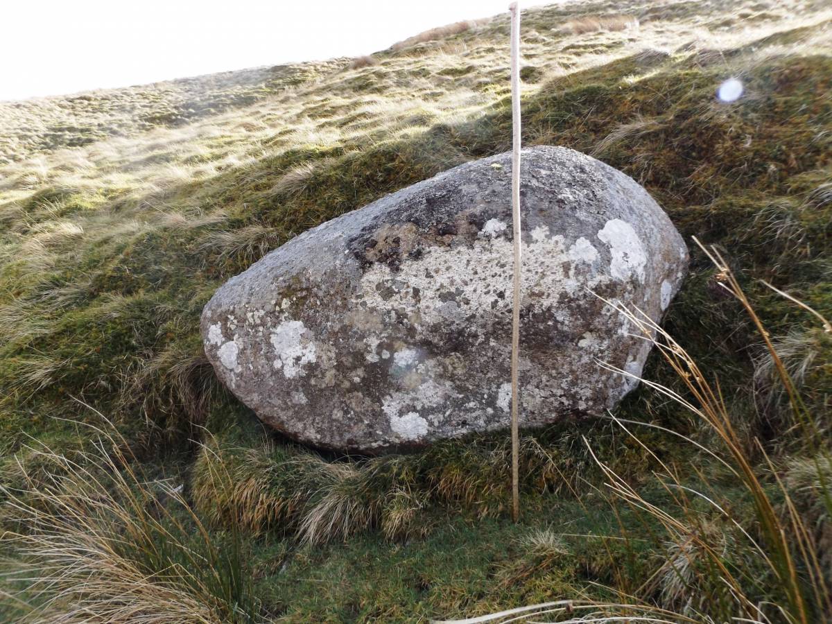
| Image 20 Description | Hunder Beck, upper reach. Shap erratic boulder. |  |