|
| *****SWAAG_ID***** | 970 |
| Date Entered | 28/12/2016 |
| Updated on | 28/12/2016 |
| Recorded by | Tim Laurie |
| Category | Photographic Record |
| Record Type | Geomorphology |
| SWAAG Site Name | |
| Site Type | |
| Site Name | |
| Site Description | |
| Site Access | Public Footpath |
| Record Date | 27/12/2016 |
| Location | Gods Bridge |
| Civil Parish | Bowes |
| Brit. National Grid | NY 956 126 |
| Altitude | 310m |
| Geology | This walk follows a permissive footpath along the South Bank of the River Greta downstream from Gods Bridge.Of particular interest are the emergence of springs from small cavities in the limestone close to the river. At least one of these has been shown to be the entrance to a cave. The Greta has formed a slight, (post glacial?) river gorge with fine exposures of the Great or Main Limestone which forms the (mostly) dry bed and banks for a distance of almost a kilometre downstream. The limestone then dips sharply before disappearing below thin bedded chert strata which is well exposed at a fine vertical North Bank Cliff. |
| Record Name | Gods Bridge, a natural limestone platform over the River Greta and a walk on excellent permissive footpaths downstream |
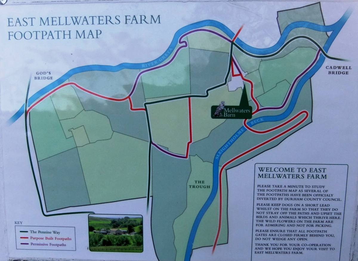
| Record Description | This record is a mainly photographic record of the many interesting features seen during winter afternoon walk on the South Bank of the River Greta downstream from Gods Bridge to the permissive footpath through the Pastures of East Mellwaters Farm. The riverside and other permissive paths on East Mellwaters Farm are shown on the excellent Footpath Map displayed at The Farm. See Image Nos below.
Whereas this record is of the walk downstream from Gods Bridge, commencing on the Pennine Way where it crosses the A66 at Pasture End I would strongly advise against parking and commencing the walk on the Pennine Way where it crosses the A66 Dual Carriageway from Pasture End. I would advise commencing this walk from East Mellwaters Farm and combining the walk upstream along the river bank to Gods Bridge with a walk on excellent permissive paths around the pastures of the Farm. The entrance to East Mellwaters Farm is off the A66 at Ordnance Survey Grid Reference NY968130.The farm offers accessible self catering accommodation in farmhouse cottages.
The car park to the left of the cottages may be used by visitors wishing to undertake the farm trail.
Alternately, commence your walk from Bowes on the Pennine Way Diversion or from Gilmonby.
|
| Dimensions | See Footpath Map. |
| Geographical area | |
| Species | |
| Scientific Name | |
| Common / Notable Species | |
| Tree and / or Stem Girth | |
| Tree: Position / Form / Status | |
| Tree Site ID | 0 |
| Associated Site SWAAG ID | 0 |
| Additional Notes | The entrance to East Mellwaters Farm is off the A66 at Ordnance Survey Grid Reference NY968130.The farm offers accessible self catering accommodation in farmhouse cottages.
The car park to the left of the cottages may be used by visitors wishing to undertake the farm trail.
This is a general record of features seen. Several features, for example the Stainmore Railway track, the chert strata and isolated ancient Yew deserve to be the subject of additional specific records.
|
| Image 1 ID | 7093 Click image to enlarge |
| Image 1 Description | Gods Bridge seen downstream from the North Bank | 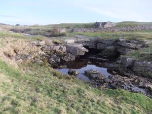 |
| Image 2 ID | 7094 Click image to enlarge |
| Image 2 Description | Gods Bridge. Resurgence springs rise from crevices in the river bed and from the limestone rocks upstream on both banks. | 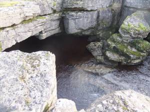 |
| Image 3 ID | 7095 Click image to enlarge |
| Image 3 Description | The Greta upstream from Gods Bridge on her way to a distant source above Stainmore | 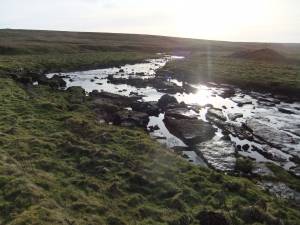 |
| Image 4 ID | 7096 Click image to enlarge |
| Image 4 Description | The Greta downstream of Gods Bridge |  |
| Image 5 ID | 7098 Click image to enlarge |
| Image 5 Description | THe East Mellwater Farm Footpath Map is posted at commencement of the walks from the Farm | 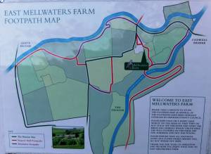 |
| Image 6 ID | 7099 Click image to enlarge |
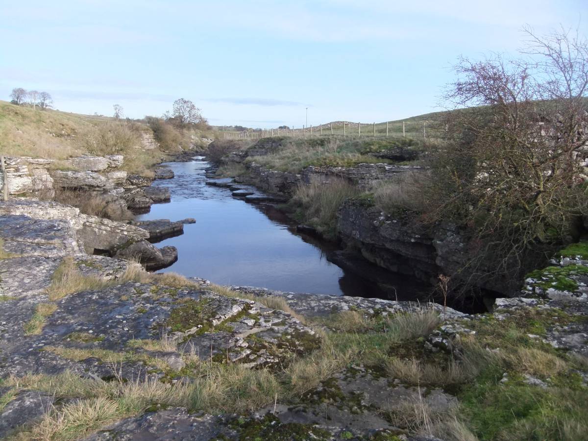
| Image 6 Description | The Greta views further downstream of Gods Bridge | 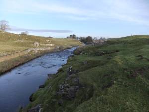 |
| Image 7 ID | 7100 Click image to enlarge |
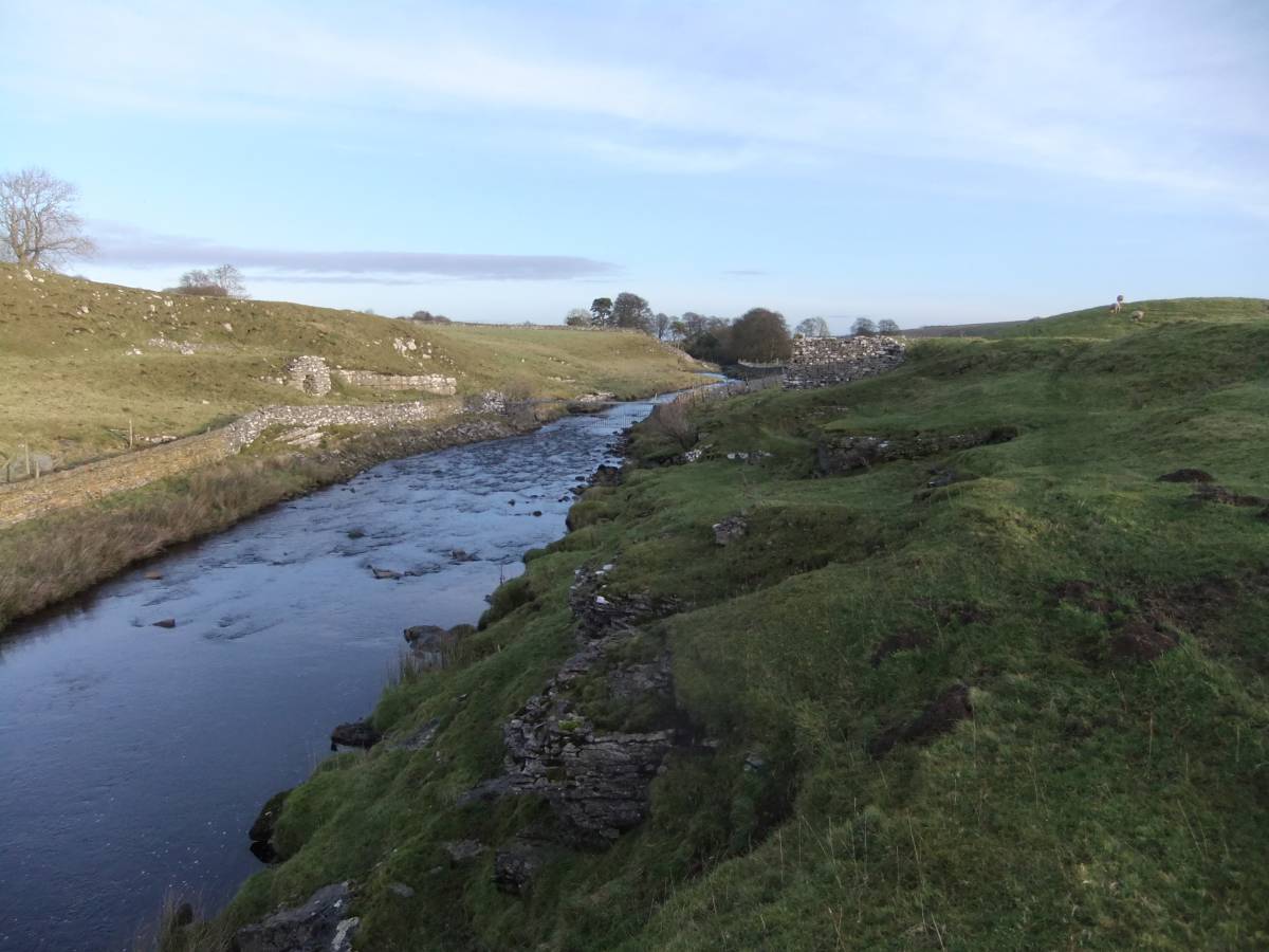
| Image 7 Description | One of the many fine disused limekilns on both banks close to the river | 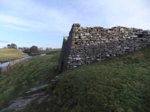 |
| Image 8 ID | 7101 Click image to enlarge |
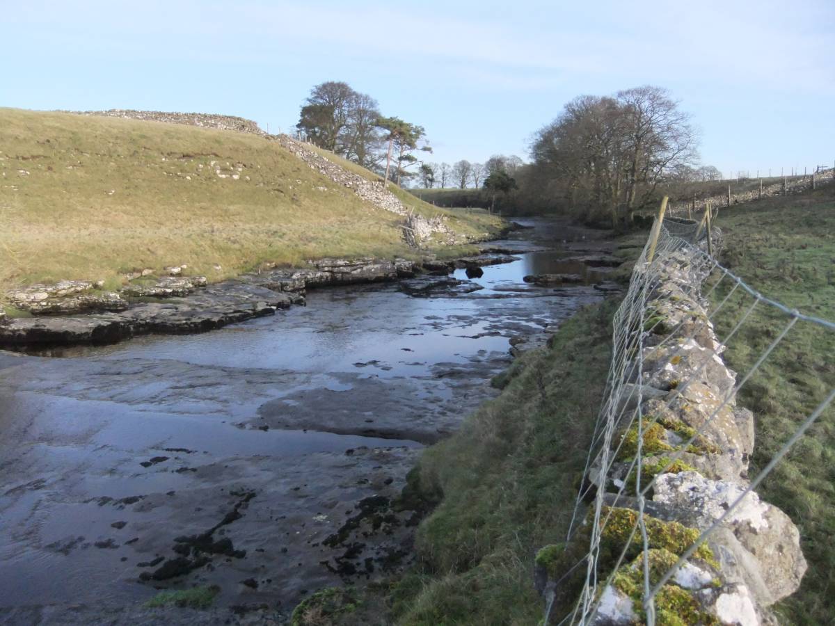
| Image 8 Description | Limestone forms the, mostly, dry bed of the Greta downstream of Gods Bridge | 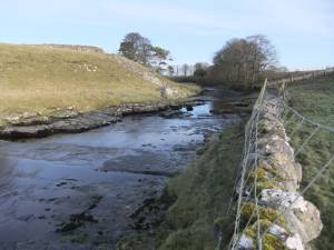 |
| Image 9 ID | 7102 Click image to enlarge |
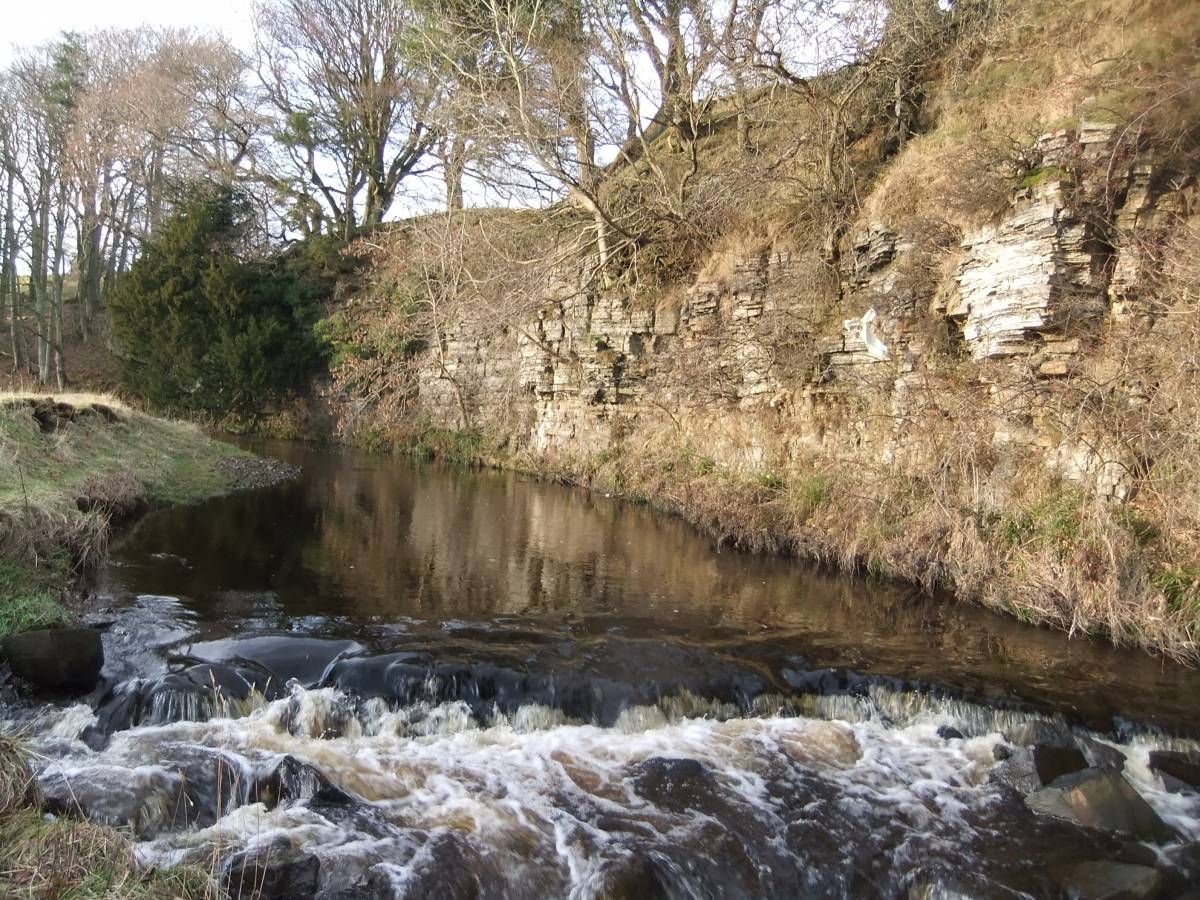
| Image 9 Description | Bend on the Greta with fine exposures of limestone. | 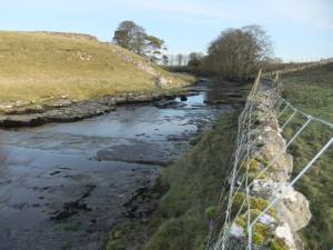 |
| Image 10 ID | 7103 Click image to enlarge |
| Image 10 Description | Bend on the Greta with fine exposures of limestone, further down. | 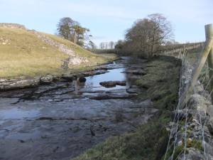 |
| Image 11 ID | 7105 |
| Image 11 Description | View from below the bend upstream to show the dry limestone bed. | 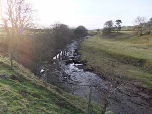 |
| Image 12 ID | 7106 |
| Image 12 Description | Isolated ancient yew on chert strata forming a vertical riverside cliff | 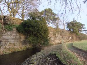 |
| Image 13 ID | 7107 |
| Image 13 Description | Detail of the thin, horizontally bedded chert strata which overlies the Main Limestone 1km downstream of Gods Bridge. |  |