|
| *****SWAAG_ID***** | 984 |
| Date Entered | 22/03/2017 |
| Updated on | 24/03/2017 |
| Recorded by | Tim Laurie |
| Category | Rock Art |
| Record Type | Archaeology |
| SWAAG Site Name | |
| Site Type | |
| Site Name | |
| Site Description | |
| Site Access | Army Range |
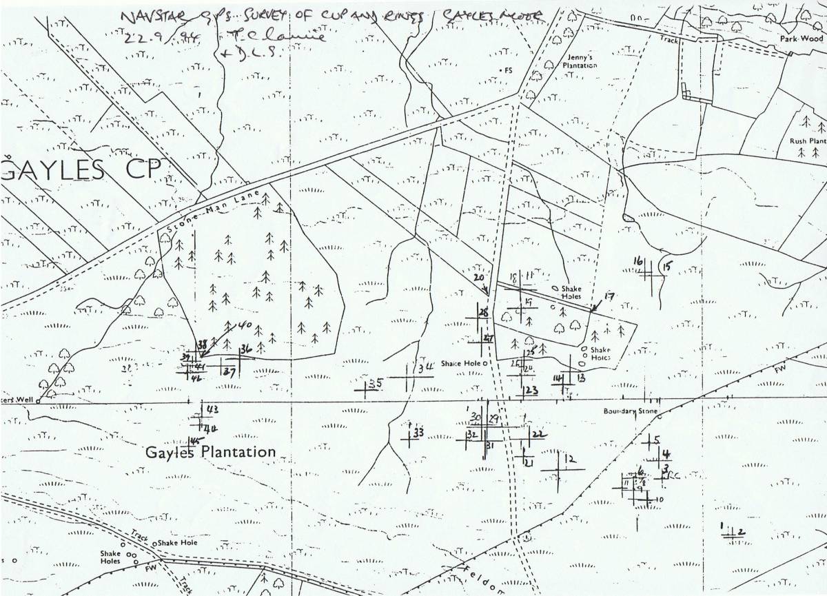
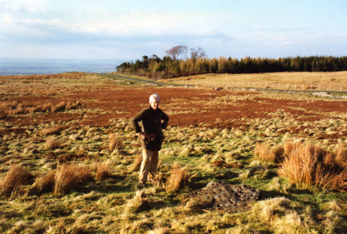
| Location | Gayles Moor, see location map of rock art sites as recorded with NAVSTAR by DLS with T.C.Laurie in 1994. 1994 |
| Civil Parish | Gayles |
| Brit. National Grid | |
| Altitude | |
| Geology | |
| Record Name | Army Range. Gayles Moor. Selected rock art surfaces. Old photographs. |
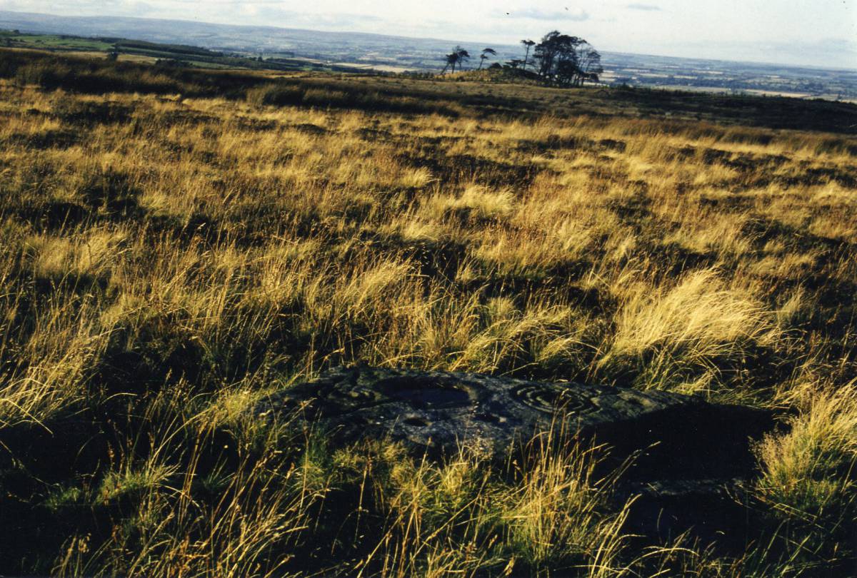
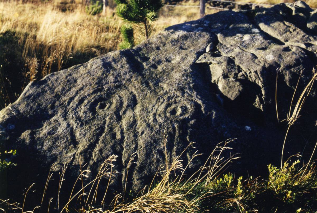
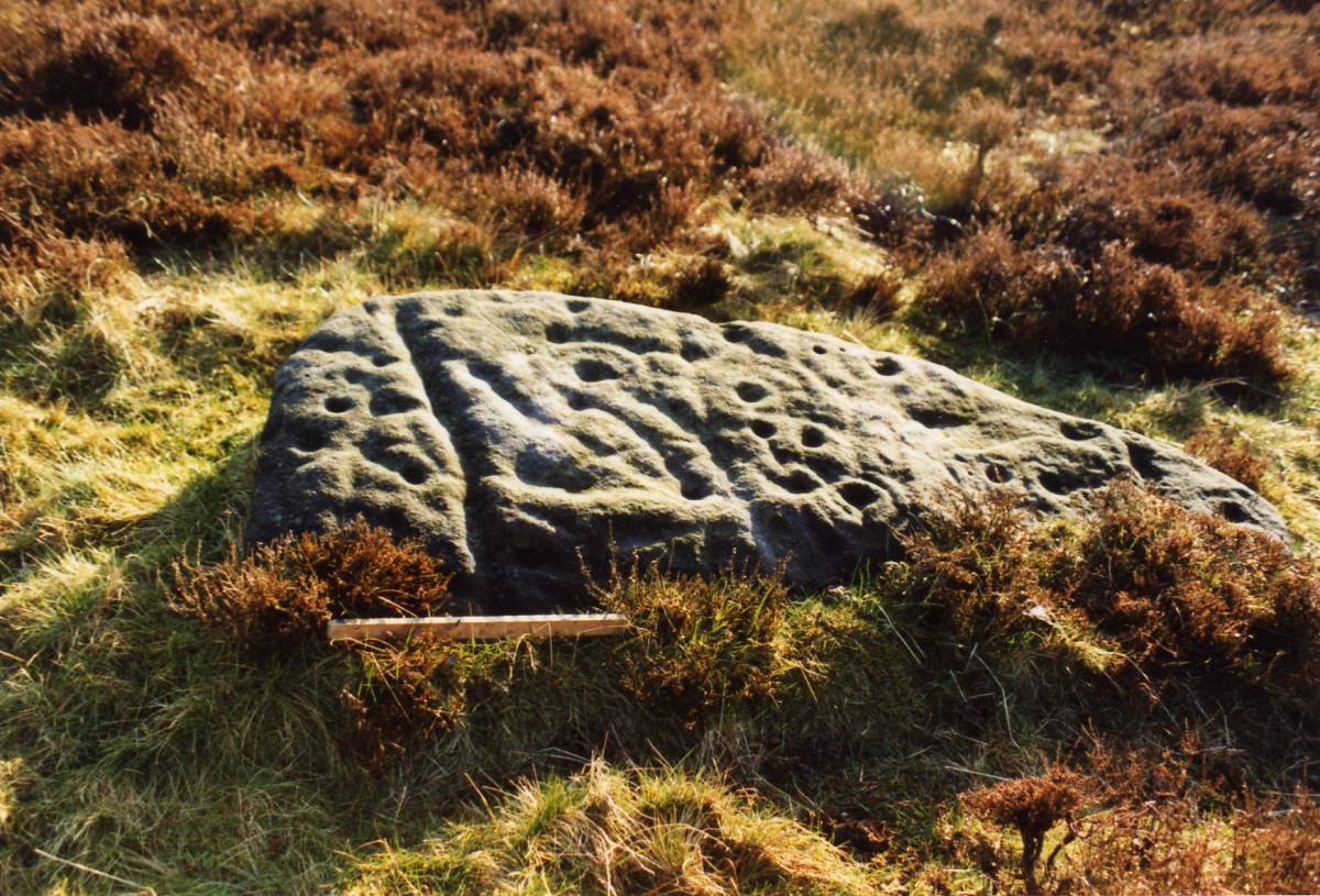
| Record Description | Army Ranges. Gayles Moor. Early photographic images of selected rock art surfaces.
For the location and details of individual surface references see Beckensall and Laurie, 1998. 'The Prehistoric Rock Art of Co Durham' and subsequent published surveys.
This record is not an inventory or record of the rocks, rather my intention is to draw attention to the perceived and on going deterioration of the rock surfaces since first photographed and to the importance of the early photographic images. |
| Dimensions | See photos |
| Geographical area | |
| Species | |
| Scientific Name | |
| Common / Notable Species | |
| Tree and / or Stem Girth | |
| Tree: Position / Form / Status | |
| Tree Site ID | 0 |
| Associated Site SWAAG ID | 0 |
| Additional Notes | It is generally thought that rock art surfaces have deteriorated and continue to deteriorate, probably as a result of acid rain, since first exposed. As a consequence, it is probable that it is now impossible to obtain photographic images of equal definition and sharpness to the best of those taken during the period of the earliest comprehensive surveys which dated to the 1970's and onwards. Moreover the detail of simple cup marks and cup and ring figures with their linking grooves on the most weathered of the rock surfaces have now almost disappeared.
Accordingly, I consider that these early photographs should be made available so that comparison with recent images is possible.
|
| Image 1 ID | 7249 Click image to enlarge |
| Image 1 Description | Navstar GPS Record of Rock Art Sites,Army Ranges, Gayles Moor. TCL and DLS 22.9.94. Possibly the first GPS Survey (by Defence Estates with TCL) of an archaeological landscape. | 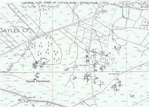 |
| Image 2 ID | 7240 Click image to enlarge |
| Image 2 Description | | 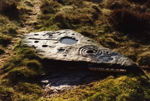 |
| Image 3 ID | 7241 Click image to enlarge |
| Image 3 Description | | 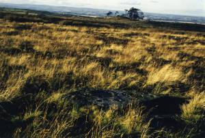 |
| Image 4 ID | 7243 Click image to enlarge |
| Image 4 Description | | 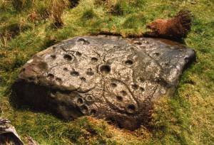 |
| Image 5 ID | 7244 Click image to enlarge |
| Image 5 Description | |  |
| Image 6 ID | 7245 Click image to enlarge |
| Image 6 Description | |  |
| Image 7 ID | 7239 Click image to enlarge |
| Image 7 Description | |  |
| Image 8 ID | 7246 Click image to enlarge |
| Image 8 Description | |  |
| Image 9 ID | 7248 Click image to enlarge |
| Image 9 Description | | 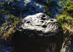 |