|
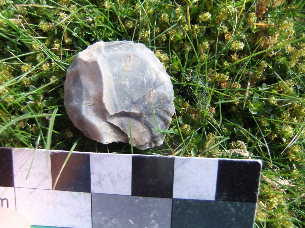
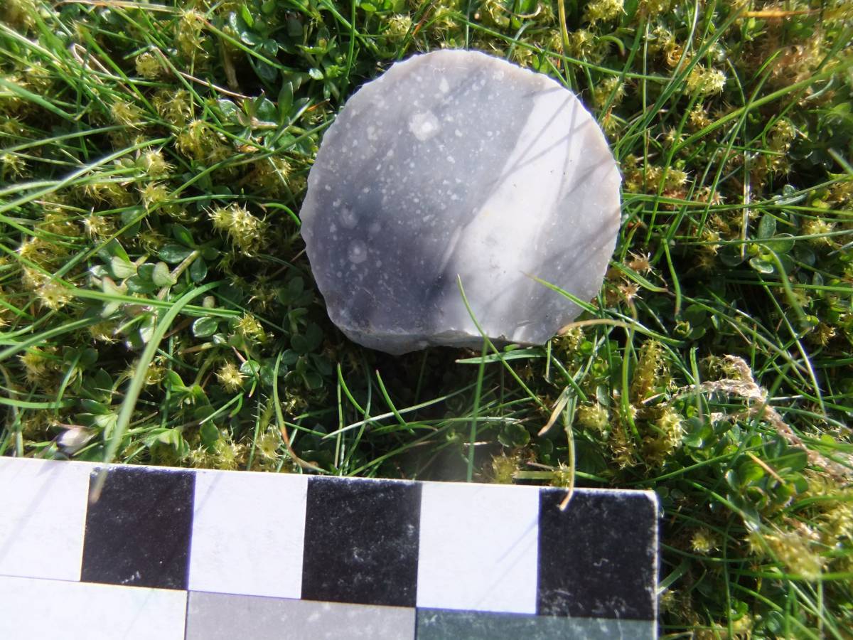
| *****SWAAG_ID***** | 989 | | Date Entered | 15/04/2017 | | Updated on | 16/04/2017 | | Recorded by | Tim Laurie | | Category | Archaeological Find | | Record Type | Archaeology | | SWAAG Site Name | | | Site Type | | | Site Name | | | Site Description | | | Site Access | Public Access Land | | Record Date | 06/04/2017 | | Location | Barningham Low Moor | | Civil Parish | Barningham | | Brit. National Grid | Hidden | | Altitude | 378m | | Geology | Drift over Namurian Five Yard Limestone series strata. | | Record Name | Barningham Low Moor. A fine flint discoidal scraper of Neolithic character. | | Record Description | This very fine discoidal scraper of unpatinated grey/white spec kled flint was found close to the Badger Way below Eel Hill. This isolated stray find was recognised by Sue and Les Knight during a recent walk with Tim Laurie across Barningham Low Moor in search of Shap Erratics. This circular scraper is steeply retouched for the whole of the perimeter except for the striking platform. Flint scrapers fully worked in this manner are characteristic of the Neolithic/Early Bronze Age in contrast to scrapers of the Mesolithic period which are characterised by end of blade scrapers and by flakes with minimal or part retouch.
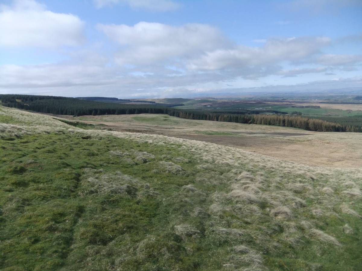
This scraper was recognised on turf close to the Badger Way Footpath where it descends from Eel Hill at the edge of the The High Moor, to Black hill Gate where it passes through the Stang Forest to Hope,Gilmonby and Stainmore.
The concentrations of prehistoric sites, for example the concentrations of Rock Art sites and the site of the Gilmonby hoard- see previous SWAAG Database Record Nos 541 and 770, are all on the line of the Badger Way. These sites confirm that the Badger Way, braided track ways which follow slightly different routes southward from Stainmore across Glmonby Moor, Barningham Moor, Gayles Moor and Feldom to Richmond, and all points south, was the preferred route for the traveller on foot from the Vale Of Mowbray to the Vale of Eden, to Galloway and to Ireland throughout Prehistory. The Badger Way is so called as it was frequented until very recently by Badgers or itinerant salesmen knocking at doors and offering to sharpen knives and provide haberdashery accessories, buttons, cotton and ribbons.
| | Dimensions | See photographs | | Geographical area | | | Species | | | Scientific Name | | | Common / Notable Species | | | Tree and / or Stem Girth | | | Tree: Position / Form / Status | | | Tree Site ID | 0 | | Associated Site SWAAG ID | 0 | | Additional Notes | Representative lithic finds from Teesdale including Barningham Moor and from Swaledale can be inspected at the Swaledale Museum, Reeth.
Lithic finds from Wensleydale can be seen at the Dales Countryside Museum, Hawes.
In the course of almost 40 years of fieldwork on the Swale-Tees/Greta interfluve, I have concluded that lithic scatters and stray finds from the mid-upper slopes of Teesdale were almost exclusively scraper dominated and of Later Prehistoric, Neolithic- Early Bronze Age character. In contrast, lithic scatters on the actual watershed, typically located close to the highest springs feeding the tributary streams of Marske Beck and of Clapgate Beck at Feldom were microlith dominated with very few scrapers and consequently of Earlier Prehistoric, Mesolithic character.
For survey details and images of settlement, rock art and lithic finds from Barningham Moor, see SWAAG Record Nos 84, 541 and 770. | | Image 1 ID | 7272 Click image to enlarge | | Image 1 Description | Barningham . The Low Moor below Eel Hill. Flint scraper, dorsal view. |  | | Image 2 ID | 7273 Click image to enlarge | | Image 2 Description | Barningham . The Low Moor below Eel Hill. Flint scraper, ventral view. | 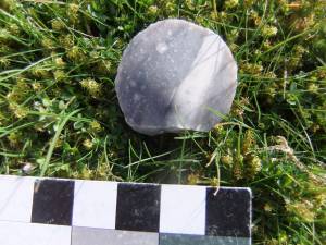 | | Image 3 ID | 7274 Click image to enlarge | | Image 3 Description | Barningham. View westward on the Badger Way from Eel Hill down across the Low Moor and Stang Forest to distant Stainmore. | 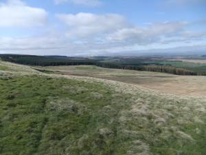 | |