|
Viewing swaag.org website implies
consent to set cookies on your computer.
Full details |
Swaledale and
Arkengarthdale Archaeology Group |
SWAAG Honorary President:
Tim Laurie FSA |
| Maps |
| Digital Copyright: All of the digital maps
available below are ©swaag.org. They are available to download
by clicking individual map images and are free to use with
acknowledgment to: Swaledale and Arkengarthdale Archaeology Group (swaag.org). The download files are large and show detail that is not apparent on the images below. SWAAG would like to acknowledge both the North Yorkshire County Council Records Office and the Heritage Lottery Fund in making this resource available. |
| Arkengathdale 1841 |
 |
| Arkengarthdale Centre |
.jpg) |
| Arkengarthdale West |
.jpg) |
| Arkengarthdale East |
.jpg) |
| Grinton Centre |
.jpg) |
| Grinton East |
.jpg) |
| Grinton West |
.jpg) |
| Grinton Village |
.jpg) |
| Healaugh Village |
 |
| Melbecks |
 |
| Melbecks East |
 |
| Melbecks West |
 |
Muker 1 |
 |
| Muker 2 |
 |
| Muker 3 |
 |
| Muker 4 |
 |
| Muker 5 |
 |
| Muker 6 |
 |
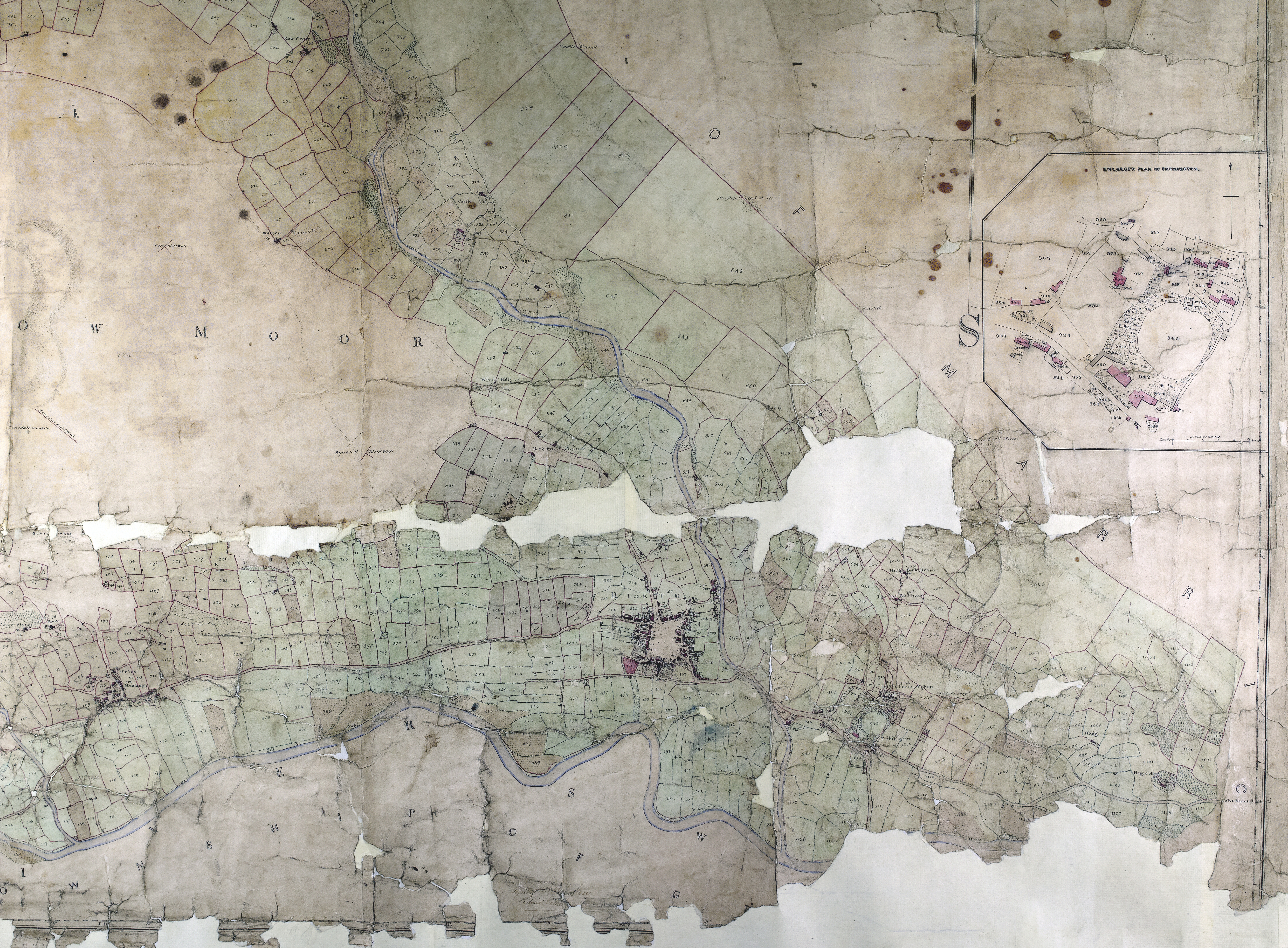
| Reeth 1 |
 |
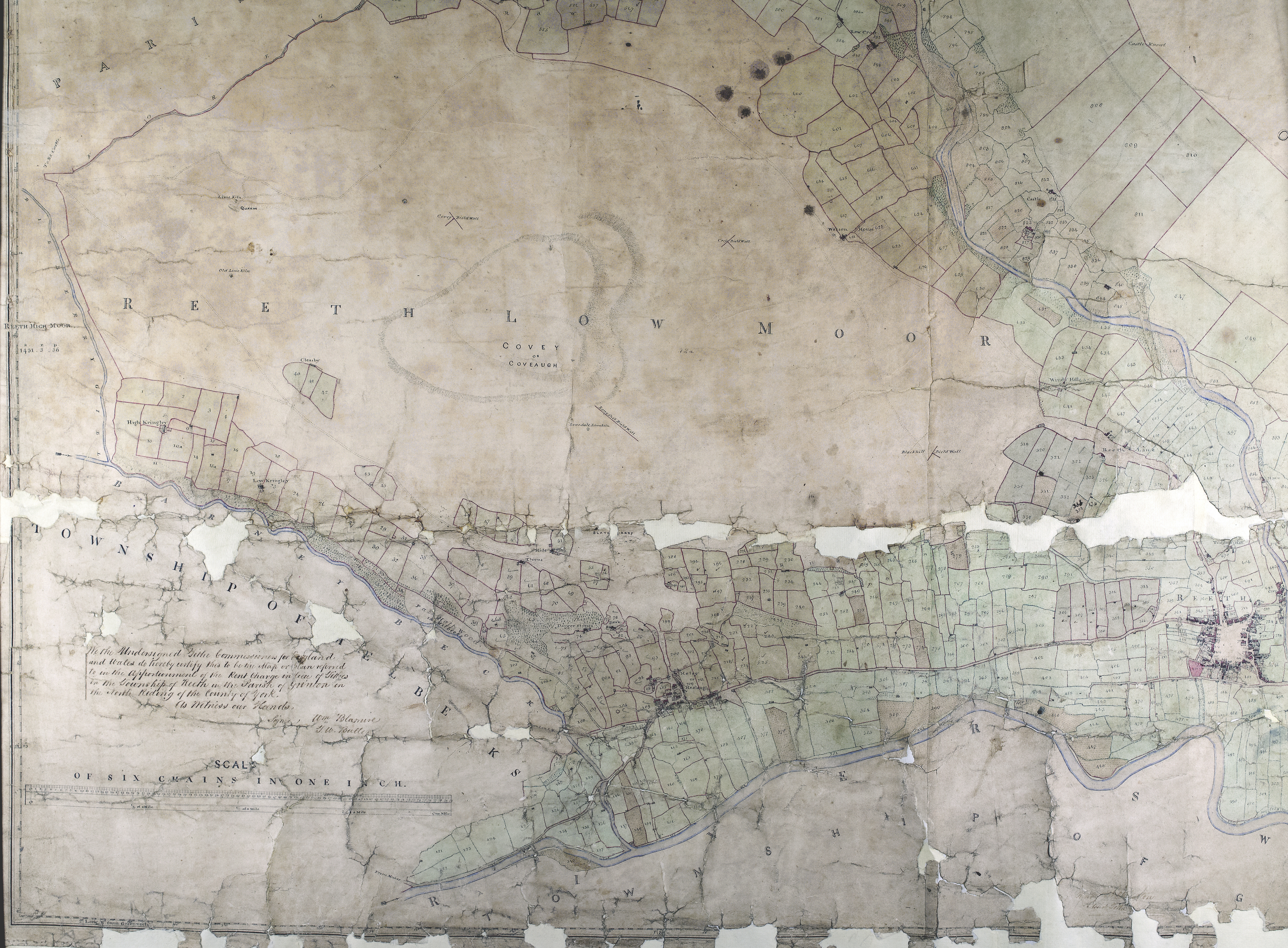
| Reeth 2 |
 |
| Reeth 3 |
 |
| Reeth 4 |
 |
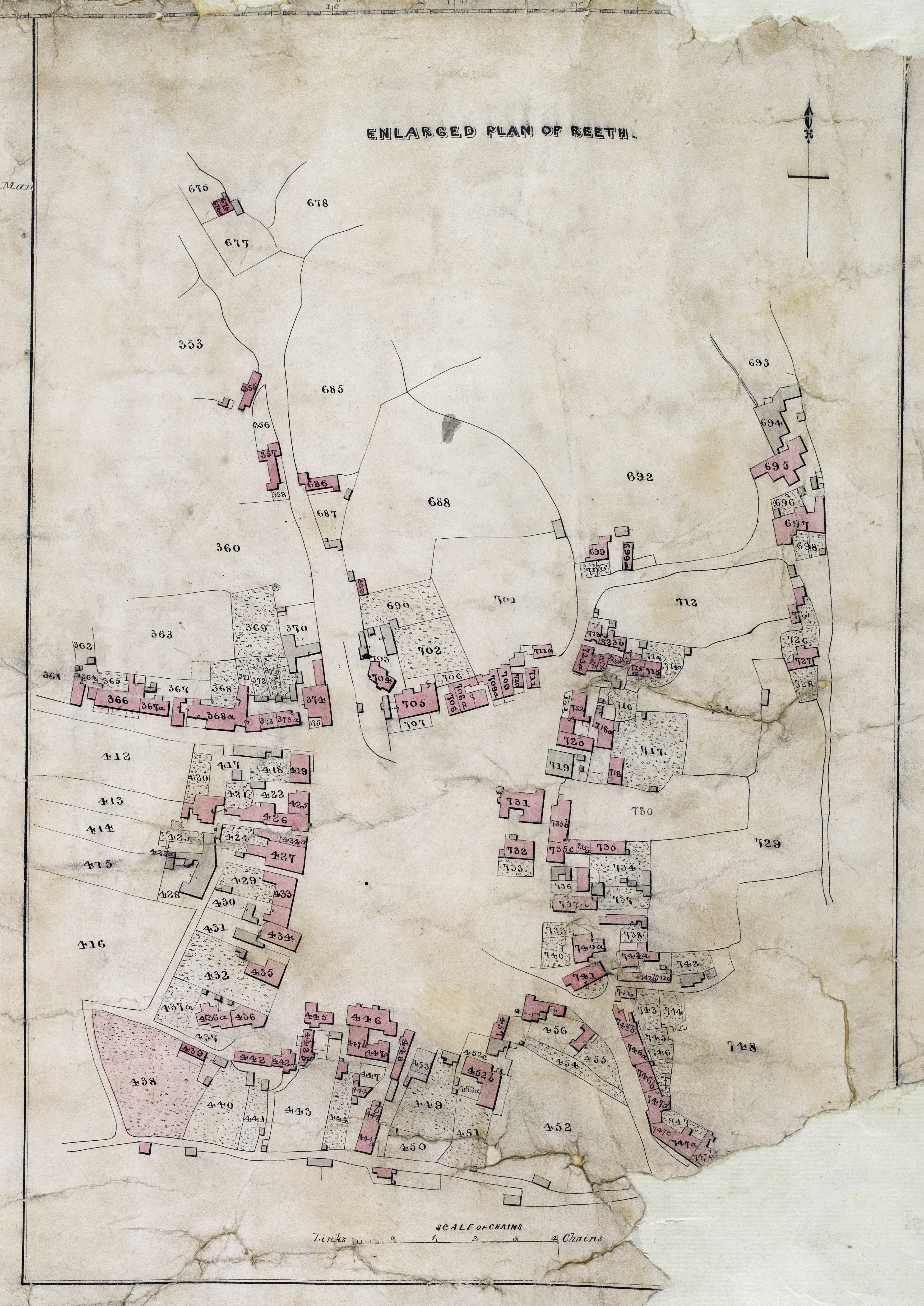
| Reeth Village |
 |
 |