|
| *****SWAAG_ID***** | 998 |
| Date Entered | 03/06/2017 |
| Updated on | 03/06/2017 |
| Recorded by | Stephen Eastmead |
| Category | Earthworks |
| Record Type | Archaeology |
| SWAAG Site Name | |
| Site Type | |
| Site Name | |
| Site Description | |
| Site Access | Public |
| Record Date | 03/06/2017 |
| Location | Grinton to Healaugh Area |
| Civil Parish | Reeth |
| Brit. National Grid | SE 03 98 |
| Altitude | |
| Geology | |
| Record Name | LIDAR images of Swale Valley either side of Reeth |
| Record Description | 4 images.
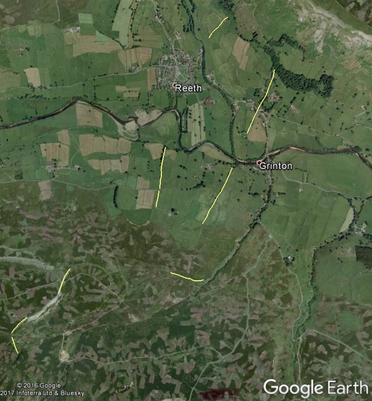
1) Google Earth view with Fremington Dykes outlined
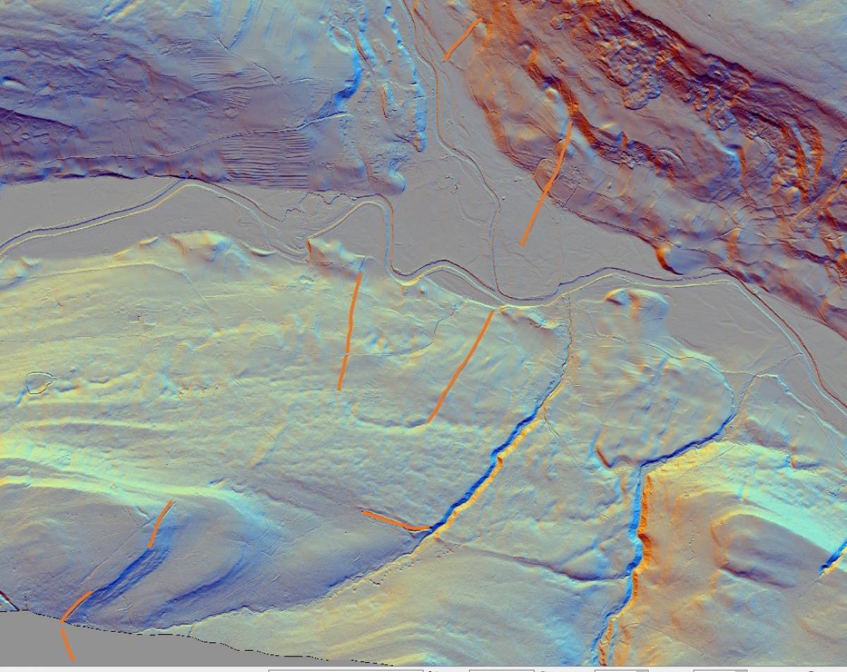
2) LIDAR view with Fremington Dykes outlined
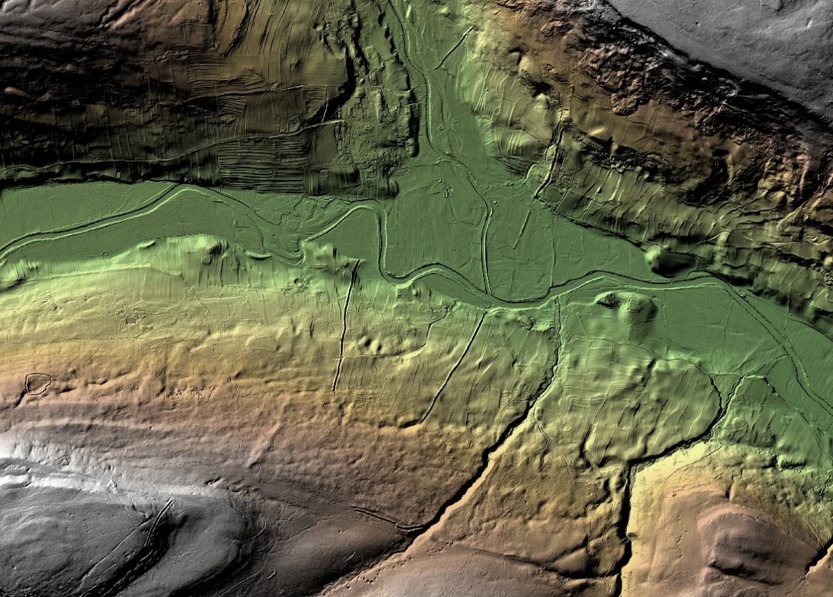
3) LIDAR view without the dykes indicated
4) More detailed LIDAR view of the area with elevations indicated with colours |
| Dimensions | |
| Geographical area | |
| Species | |
| Scientific Name | |
| Common / Notable Species | |
| Tree and / or Stem Girth | |
| Tree: Position / Form / Status | |
| Tree Site ID | 0 |
| Associated Site SWAAG ID | 0 |
| Additional Notes | |
| Image 1 ID | 7376 Click image to enlarge |
| Image 1 Description | Google Earth view of Fremington Dykes | 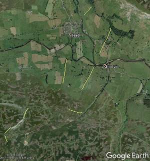 |
| Image 2 ID | 7378 Click image to enlarge |
| Image 2 Description | LIDAR view of Fremington Dykes |  |
| Image 3 ID | 7380 Click image to enlarge |
| Image 3 Description | LIDAR view out of Fremington Dykes indicated | 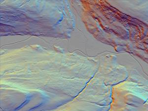 |
| Image 4 ID | 7381 Click image to enlarge |
| Image 4 Description | Detailed LIDAR view - see full screen and zoom in for more detail by pressing Control and + to zoom in and Control and - to zoom out. The arrow keeys will move the image around too. | 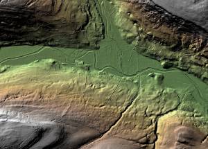 |