| The swaag.org website uses cookies to provide website use and other information. Full details | Swaledale and
Arkengarthdale Archaeology Group Swaledale Geology Pages © John Russell |
SWAAG Honorary President:
Tim Laurie FSA |
Ripple Marks
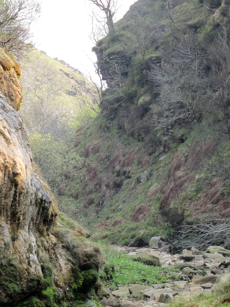 Location: How Edge Scars. BNG: NY 867 026 |
||
 |
Click images to enlarge |
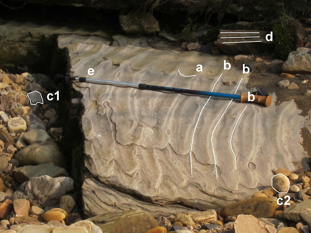 |
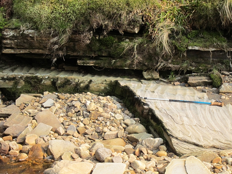
| a. Symmetrical ripple marks that have the same slope on either
side of the crest. b. Flattened ripple crests c1. Limestone boulder c2. Sandstone boulder d. Fissile sandstone – Mica rich. e. Direction of river flow – not related to the ripple marks. |
||
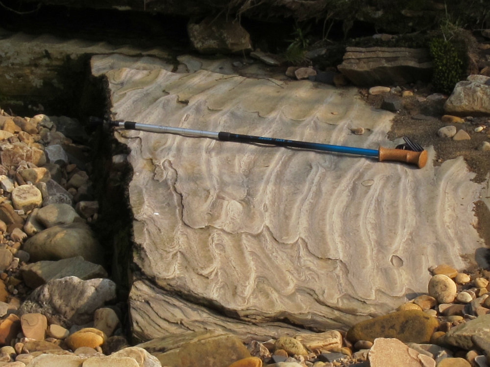
| The photo shows ripple marks in medium-grained deltaic sandstone
of Namurian age. Travel up any of the river beds onto the
Millstone grit and these features are common in the sandstones.
They provide geologists with useful information about
palate-environments. Ripple marks are found in many environments
e.g. tidal flats, beaches, lakes, seas and rivers. The water
depth can vary from very shallow down to a depth of 200m. There
are many factors that control the size of the ripples. The three
most common are the coarseness of the grain, the water depth and
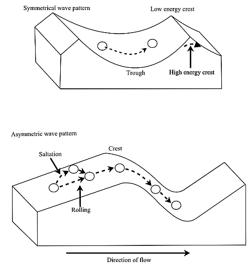
the intensity of the waves. The ripple marks can provide information about the water that created them. There are two main groups of water ripple marks shown in the diagram below.
The photograph shows a symmetrical wave pattern (a) which indicates a marine environment. It is like the first diagram with the crests removed. This reflects a higher energy deposition. The second diagram shows an asymmetrical wave pattern formed in a river. The steeper slope of the wave points downstream. Ripple marks can also be useful in working out the way up of a rock sequence. The river in the photo shows a river bed with a number of water worn boulders. This rounded appearance is due to three elements of erosion, attrition, corrosion and solution. These boulders are part of the bedload of the river that is being carried to the sea and deposited. The angular boulder (c1) is a very hard limestone which shows smooth, water worn surfaces. The boulder marked (c2) is of softer sandstone. It’s almost spherical form is a result of corrosion and attrition as it collides with other boulders and the river bed. |
||
 |
||