|
| *****SWAAG_ID***** | 227 |
| Date Entered | 13/06/2011 |
| Updated on | 04/02/2012 |
| Recorded by | Tim Laurie |
| Category | Settlement |
| Record Type | Archaeology |
| Site Access | Army Range |
| Record Date | 01/01/2005 |
| Location | Low Feldom |
| Civil Parish | Marske |
| Brit. National Grid | NZ 114 040 |
| Altitude | 320m |
| Geology | The Main Limestone |
| Record Name | Deserted medieval Village at Low Feldom, Marske CP |
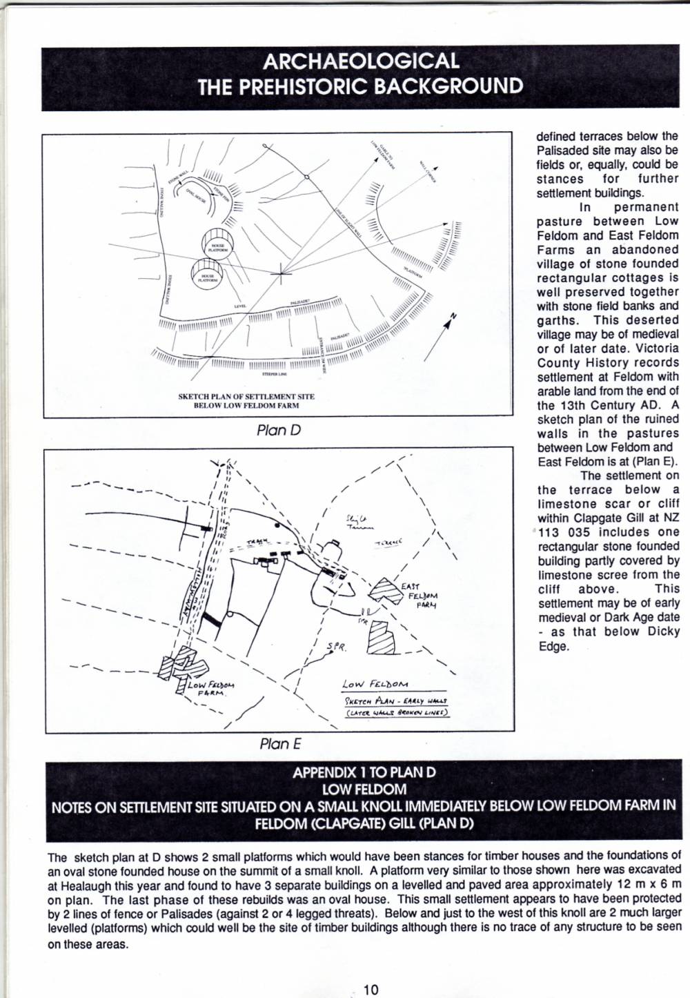
| Record Description | This site was first recognised and described by T.C.Laurie, 1990. Catterick & Feldom Conservation Group Monograph, 1990. pp7-12 "West Feldom-The Archaeological Background". See Plan �E.�.
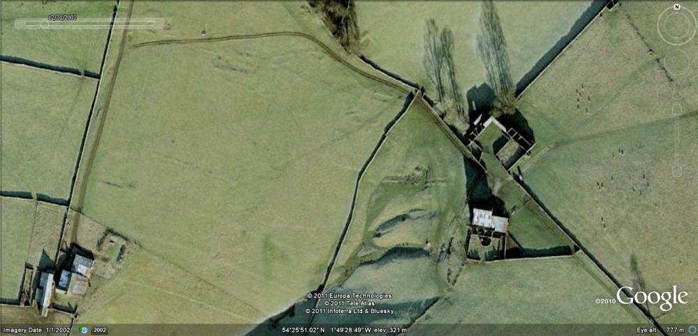
The remains of the small medieval hamlet at Low Feldom are located in pasture between the now abandoned 19C farm buildings at Low Feldom and East Feldom Farms. Nine rectangular buildings have been recognised (Laurie 1990, Plan E) although Wessex Archaeology list just six. Individual buildings range in size from 26m*6m(Building 2)and 19m*7m (Building 1), 20m*5 (Building 4) to 13*5 (Building 5).
Various other structures, small enclosures and a field system, once more extensive, have been preserved in the vicinity of the hamlet but have been cleared by later ploughing in the adjacent improved pastures, see Wessex plan fig 4.
The nettle covered midden at the south end of Building 1 has produced sherds of pottery provisionally dated to the 12/13 C.
VCH records settlement with arable land at Feldom from the 13C.
Other stone walled enclosures which overlie an earlier, RB or prehistoric settlement (Wessex Figure 3) which are also likely to be medieval have been recorded in the Gill below Low Feldom Farm.
This complex of sites was surveyed to modern standards by Wessex Archaeology
Wessex Archaeology Clapgate Gill, Feldom Gate Archaeological Survey
Report, January 2004. This survey report was commissioned by Defence Estates.
This was resurveyed in 2012 by Gill Savage click here to view.
|
| Dimensions | See survey details. |
| Image 1 ID | 804 Click image to enlarge |
| Image 1 Description | Deserted Medieval Village between Low Feldom and East Feldom Farms. Google Historical Image. | 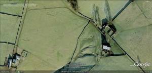 |
| Image 2 ID | 1064 Click image to enlarge |
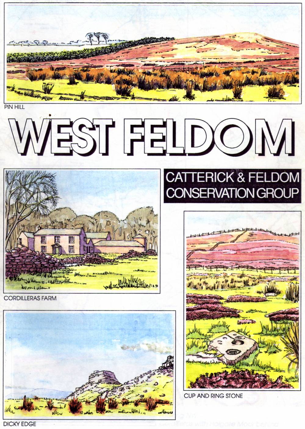
| Image 2 Description | West Feldom. Catterick and Feldom Conservation Group Monograph 1990. Cover page. |  |
| Image 3 ID | 1065 Click image to enlarge |
| Image 3 Description | Low Feldom Deserted Medieval Village. Plan E. Extract from Laurie 1990. | 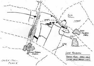 |
| Image 4 ID | 1066 Click image to enlarge |
| Image 4 Description | Low Feldom Farm. Settlement on knoll below Farm. Extract from Laurie 1990. | 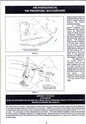 |